 |
| The first woman in radio astronomy, Australian Ruby Payne-Scott |
History of Scientific Women
Asteroid 2012 KP 24, a smallish rock about 25 meters (80 feet) across, will pass pretty close to the Earth on May 28, buzzing us at a distance of about
Closest approach is at about 15:00 UTC (11:00 a.m. Eastern US time) on May 28.
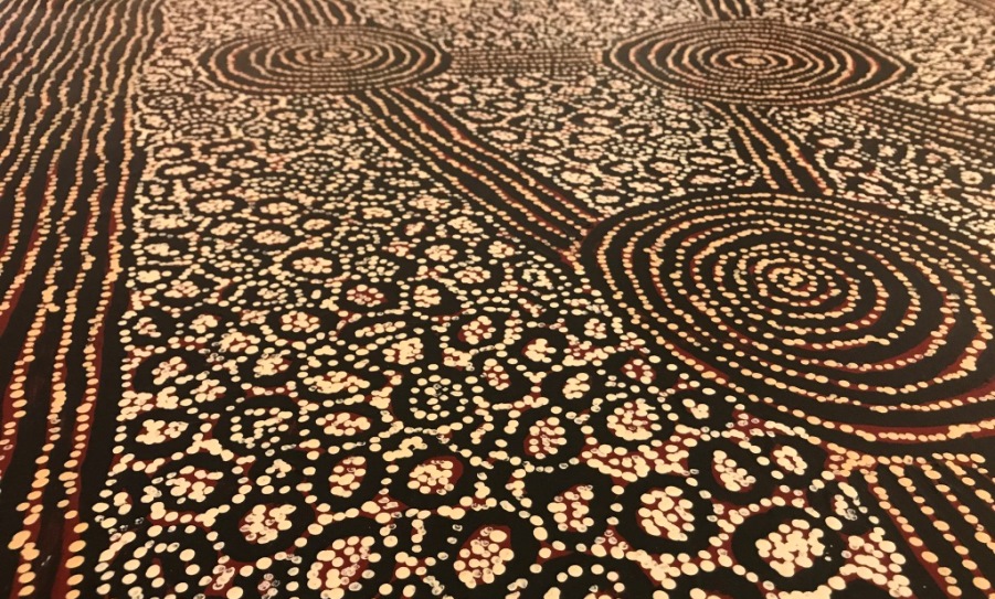 |
| art by George Ward Tingari |
The Rainbow Serpent
Lake Rason is located 187.21kms East of Laverton, 363.64kms SouthWest of Warburton and 374.99kms NorthEast of Kambalda, in the state of Western Australia. On May 23 — the day after the SpaceX dragon capsule launch - International Space Station astronaut André Kuipers snapped this shot of the Earth: except he didn’t say what this feature was!
Lake Rason, when full, covers an area of around 16000 hectares and is located in WA. Lake Rason is fed by the Bertha Creek (28S37 124E22)
Towns, villages or cities near the lake include Laverton, the town of Leonora, and the city of Kalgoorlie-Boulder.
Phil Plait of Bad Astronomy did the detective work with identifying this dry lake feature as belonging to Australia and not Peru. Lucky we have Phil!
Great Victoria Desert
There are two wetlands of regional significance contained within the Great Victoria Desert: Lake Minigwal and Lake Rason. Both are significant for the maintenance of ecological processes. Lake Minigwal is a seasonal intermittent saline lake with a static trend and in good condition. Threatening processes include feral animals and a changed hydrology due to de-watering of mine sites and discharge of hypersaline water into lake beds. Lake Rason is also a seasonal intermittent saline lake with a static trend, but it is in near-pristine condition with mineral exploration and feral animals as threatening processes.

Image Source: Dr Hick's Range Lake Rason
The Mineral Explorer
Aura Energy (ASX: AEE) is a uranium explorer with advanced projects in Sweden, West Africa and Australia. The company is focusing on two main projects: the Storsjön Project located in Sweden’s Alum Shale Province, one of the largest depositories of uranium in the world; and the highly prospective Reguibat Project in Mauritania.
Aura Energy’s main projects in Sweden are based on the Alum Shales, which have been historically known as one of the largest depositories of uranium in the world. Aura Energy has exploration permits and applications in three regions in west Africa: the Reguibat Craton in Mauritania, the Mauritanide Fold belt in Mauritania, and the Tim Mersoi Basin in Niger.
Current Operations:
The Neale Project comprises two large exploration licence applications covering 377 square kilometres of Lake Rason and the radiometrically anomalous channel that leads southeastwards into the Eucla Basin. The Project extends over a 57 kilometre length of the drainage system.There is a striking similarity between the geological and geographical setting of the Neale Project and those of the Ponton and Mulga Rocks uranium deposits to the southwest. The sandstone-hosted deposits formed in Tertiary palaeo-channels cut into the eastern margin of the Archaean Yilgarn Block. At Ponton and Mulga Rocks, oxidised groundwater carrying uranium is interpreted as having come into contact with carbonaceous material in the channel sediments, causing the uranium to precipitate.
The digital elevation model shows that the relief pattern at Neale resembles that in the Ponton area, adjacent to Aura's Kirgella Rocks Project. From this comparison, it is interpreted that the Lake Rason channel is filled with Tertiary sediments similar to those at Ponton and Mulga Rocks, providing a good exploration opportunity to test their potential.
Radiometric coverage is incomplete for the project area. There is standard Geoscience Australia coverage for the western part of the Project Area. However, the eastern section has been flown recently, and only a preliminary radiometric image has been released by the Western Australia Department of Industry and Resources. However, strong radiometric features occur along the length of Lake Rason. In addition the preliminary image for the eastern part of the Project Area indicates that these radiometric features extend to the eastern end of the lake, and along the drainage system to the south.
No systematic exploration for any commodity is reported for the area of the Neale Project tenements. W. Johnson and J.W. Johnson held a Temporary Reserve that included part of Lake Rason within the Neale Project in 1981. The tenement holders carried out field follow-up of a single radiometric anomaly within the Neale Project. This was located on the northern shore of Lake Rason, where lake sediments overlay highly weathered sandstones of the Paterson Formation. One sample that was assayed from this locality contained 25ppm uranium. This indicates that the processes that lead to calcrete uranium deposition are occurring in the Lake Rason area, and confirms the potential for this style of mineralisation in the Project Area.

A Promethean Flame
No comments:
Post a Comment